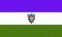
Sonsonate Department (Departamento de Sonsonate)
 |
 |
The department has a population of over 463,000 and an area of 1,226 km².
Created on June 12, 1824. The El Salvador National Parliament decided on January 29, 1859 to separate from the department the cities of Apaneca, San Pedro Puxtla, Guaymango and Jujutla and give these cities to Santa Ana Department.
Sonsonate City was the second capital of the Federal Republic of Central America in 1834.
The department remains the heart of the Pipil culture in the country, home to several ancient traditions and to most of the few remaining Nahuatl speakers in El Salvador.
It is an overwhelmingly agricultural area, with extremely fertile volcanic soils that once were the most valuable resource in Central America for the Spanish conquistadors who profited from its ancient cacao plantations. Its name appropriately means "Place of 400 rivers" or "Place of many waters" as it receives well over 2,000mm (79 inches) of rain a year.
* 1) Acajutla
* 2) Sonsonate
* 3) Armenia
* 4) Caluco
Map - Sonsonate Department (Departamento de Sonsonate)
Map


Country - El_Salvador
 |
 |
| Flag of El Salvador | |
Among the Mesoamerican nations that historically controlled the region are the Lenca (after 600 AD), the Mayans, and then the Cuzcatlecs. Archaeological monuments also suggest an early Olmec presence around the first millennium BC. In the beginning of the 16th century, the Spanish Empire conquered the Central American territory, incorporating it into the Viceroyalty of New Spain ruled from Mexico City. However the Viceroyalty of New Spain had little to no influence in the daily affairs of the isthmus, which was colonized in 1524. In 1609, the area was declared the Captaincy General of Guatemala by the Spanish, which included the territory that would become El Salvador until its independence from Spain in 1821. It was forcibly incorporated into the First Mexican Empire, then seceded, joining the Federal Republic of Central America in 1823. When the federation dissolved in 1841, El Salvador became a sovereign state, then formed a short-lived union with Honduras and Nicaragua called the Greater Republic of Central America, which lasted from 1895 to 1898.
Currency / Language
| ISO | Currency | Symbol | Significant figures |
|---|---|---|---|
| SVC | Salvadoran colón | 2 | |
| USD | United States dollar | $ | 2 |
| ISO | Language |
|---|---|
| ES | Spanish language |